Guides
Safety, health and altitude in Kyrgyzstan
A calm look at what actually goes wrong in Kyrgyzstan: thin air above 3,000 m, mountain weather, rough roads and river fords, and the border zones where a permit is compulsory.
Most of what goes wrong here is mechanical or meteorological: a pass closes, a river rises, or somebody goes from 800 m to 3,000 m in a day.
Altitude
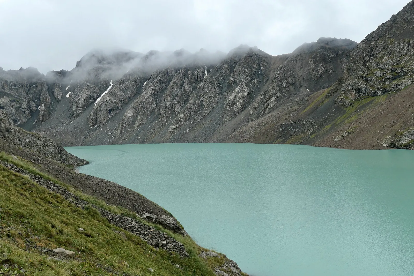
Bishkek sits at 800 m, and a normal week takes you from there to a yurt at Song-Kul at 3,016 m, sometimes in one day over the Kalmak-Ashuu pass at 3,446 m. Ala-Kul is 3,560 m, Kel-Suu 3,514 m and the Lenin Peak base camp 3,600 m.
Above roughly 2,500 m many people feel it: headache, broken sleep, breathlessness on any slope. It settles if you climb slowly, drink plenty and take the first afternoon easy; an extra night lower down helps most. Worsening symptoms, especially confusion or an unsteady walk, mean descending at once. Ask your doctor before you travel.
Weather and mountain roads
Seasons here are about snow on passes, not town temperatures. The Ala-Kul trail is clear from early July to mid or late September; outside that the pass holds snow and the descent turns dangerous. Kalmak-Ashuu opens in late May and shuts with the first snow in mid-October. Fresh snow reaches 3,200 m in any summer month, so carry a shell and let the seasons decide your route.
Bishkek to Osh is 680 km and 12 hours over the Too-Ashuu and Ala-Bel passes, both above 3,000 m: open all year, slowed by snow from November to April, with avalanche risk on the Suusamyr stretch. Karakol to Altyn-Arashan is 30 km and three hours of broken rock.
- Four-wheel drive is needed for Song-Kul, Altyn-Arashan, Kel-Suu, Kazarman and Saimaluu-Tash.
- High clearance is enough for Tash-Rabat in dry weather.
- The Barskoon gorge road supplies a mine, so expect heavy trucks.
- Livestock on the road at dusk is normal; avoid night driving.
Several routes ford rivers rather than bridge them: into Kel-Suu the water can rise above the floor of the car. Meltwater peaks in the afternoon, so cross early and let the driver decide. Getting around covers the vehicles.
Water, sun, ticks and dogs
- Drink water that has been boiled, bottled or filtered; streams on the pastures run below large flocks, so treat them however clear they look.
- At a bazaar, food cooked in front of you beats food that has stood in the sun.
- Sunburn comes fast above 3,000 m and on snow, and the spring sun in the south is stronger than it feels.
- Ticks are active in grass and scrub in spring and early summer: cover your legs and check each evening.
Every summer pasture has working dogs guarding the flock, and they read an approaching walker as a threat: go wide around the yurts and the animals, keep a steady pace rather than running, and wait for the herders to call them back. Trails above Jyrgalan cross grazing.
Talk to a doctor or a travel clinic before departure about vaccinations, tick-borne illness and anything you take regularly, and carry insurance covering trekking, riding and evacuation at the altitudes on your route.
Border zones and permits
The Chinese and Tajik frontiers are lined with border zones where a permit is compulsory. Kel-Suu needs one for you and for your driver, and only the stamped paper original is accepted: copies are turned away. Allow two to three weeks.
- Also inside border zones: the Lenin Peak base camp, Tulpar-Kul, the Chatyr-Kul basin with its Torugart checkpoint, and the Karkyra valley beside Jyrgalan.
- No permit is needed for Tash-Rabat, Altyn-Arashan, Saimaluu-Tash or Batken district.
- Permits come from Bishkek, Naryn and tourism offices, never at the barrier.
Out of signal
There is no mobile coverage at Besh-Tash or Chatyr-Kul and none to rely on at Altyn-Arashan or Kel-Suu, so leave your route and expected return with your guesthouse. Permit lead times are why an itinerary here, including our tours, is fixed weeks ahead.
Good to know
Questions travellers ask
- Is Kyrgyzstan safe for travellers?
- For most visitors the risks are practical rather than criminal: mountain roads, changeable weather at altitude, river fords and remoteness. Cities call for the same sense you would use in any city, especially around crowds and unlicensed taxis. The real planning goes into passes, permits and season, and into insurance that covers trekking and evacuation at the heights on your route.
- Will I get altitude sickness?
- Some people feel the altitude above 2,500 m, and at the Lenin Peak base camp at 3,600 m most notice something on the first night: headache, poor sleep, breathlessness on any slope. Going up slowly, drinking plenty and taking the first afternoon easy usually settles it. If symptoms worsen, or there is confusion or unsteadiness, descend at once. Discuss altitude with your doctor before you travel.
- Can I drink the tap water?
- Treat drinking water as something to boil, filter or buy in bottles, in towns and in the mountains alike. Guesthouses and yurt camps keep boiled water for tea throughout the day and that is the easiest supply. Streams on the summer pastures run below large flocks, so filter or treat them however clean the water looks. Most travellers get nothing worse than a couple of unsettled days.
- Which places need a border permit?
- Kel-Suu and Chatyr-Kul, the Lenin Peak base camp at Achik-Tash, Tulpar-Kul, the road above the Barskoon waterfalls towards the Arabel plateau, and the Karkyra valley beside Jyrgalan. The permit covers your driver too, takes about five to ten working days, and must be shown as a stamped paper original. Tash-Rabat, Altyn-Arashan, Saimaluu-Tash and Batken district need no permit.
- How do I deal with the dogs at sheep camps?
- Assume every yurt on a summer pasture has dogs and that they are working animals guarding a flock. Walk a wide line around the camp rather than between the yurts and the sheep, keep moving at a normal pace instead of running, keep trekking poles lowered, and let the herders call the dogs back before you carry on past.
- Do I need travel insurance?
- Yes, and it needs to match the trip. Check that it covers trekking and horse riding at the altitudes on your itinerary, that the altitude ceiling is high enough for places such as Ala-Kul at 3,560 m or the walk to about 4,100 m above the Lenin Peak base camp, and that it includes helicopter evacuation. Several valleys have no mobile coverage, so getting out takes time.
Guides
Read next
Kyrgyz food and how to be a good guest
What Kyrgyz kitchens actually serve, what to expect if you avoid pork or meat altogether, and how to behave as a guest in a family home, a yurt or at a sacred site.
Visas, border permits and entry to Kyrgyzstan
How entry works in practice: the three visa categories, what the border asks for, the registration rule for long stays, and the permits a visa does not cover.
The best time to visit Kyrgyzstan, month by month
The mountain season is short and the calendar is set by passes rather than by weather, so here is what is open, what is shut and what is worth the trip in each month.
Your route is one conversation away
Tell us your dates, your pace and what you would like to see. We will put together a route from our own suppliers.