Naryn · Kyrgyzstan
Chatyr-Kul Lake
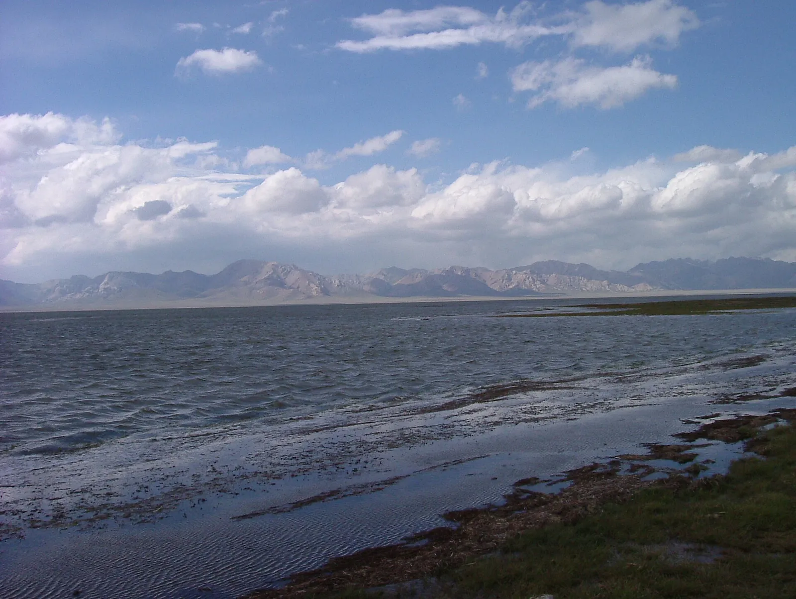
Chatyr-Kul is a large lake without an outflow at about 3,530 m in At-Bashy district, near the Torugart Pass on the Chinese border. Part of the lake and its shore belongs to the Karatal-Japyryk reserve, and the lake is a Ramsar wetland used by migrating waterbirds such as the bar-headed goose. The Torugart highway runs through the basin. Travellers come on a day trip from Naryn or ride over the pass from the Tash-Rabat yurt camps in two days. A border-zone permit is required.
- Region
- Naryn
- Altitude
- 3,530 m
- Roads
- Any car
What Chatyr-Kul is
Chatyr-Kul is a large lake with no outflow at about 3,530 m in At-Bashy district, not far from the Torugart pass and the Chinese border. The basin around it is wide, treeless and very open — high plain rather than gorge. Part of the lake and its shoreline belongs to the Karatal-Japyryk reserve, and the lake is a listed Ramsar wetland: migrating waterbirds stop here, the bar-headed goose among them.
Permits and checkpoints
The lake sits in the border zone, so a permit is required and a military checkpoint on the Torugart highway will ask to see it. Only the stamped paper original is accepted, and your driver needs one as well. Processing through agencies or community tourism offices takes roughly one to two weeks, so apply two to three weeks ahead; close to the Chinese border, earlier is safer.
When to go
Chatyr-Kul is frozen from October until late April. The Torugart road is normally clear of snow from about the end of May to the end of September, and that is when visits happen. Even at the height of summer this is a cold, windy place to stand around in, and the weather changes quickly.
Getting there
Most travellers come as a long day from Naryn — around 170 km and four hours, asphalt along the Torugart highway and then a gravel track down to the shore, for which four-wheel drive is needed. From Tash-Rabat it is about 85 km and two hours by road. On horseback from Tash-Rabat, the pass above the valley (3,800–4,000 m) gives a view over the lake after roughly four hours; reaching the water itself takes about two days and 22 km, and the same permit applies.
Practical notes
There is nowhere to stay at the lake. Travellers sleep in the yurt camps at Tash-Rabat and come over for the day, or take in Chatyr-Kul on the way between Tash-Rabat and Kel-Suu. Carry your passport as well as the permit, expect no mobile coverage and no shop, and bring cash, food and wind protection for the day.
Good to know
Questions travellers ask
- Do you need a permit to visit Chatyr-Kul?
- Yes. The lake is inside the border zone near the Torugart pass, and a military checkpoint on the highway checks permits. Only the stamped paper original is accepted, and the driver needs one too. Agencies and community tourism offices arrange them in roughly one to two weeks, so apply two to three weeks before you travel.
- When is Chatyr-Kul free of ice?
- The lake is frozen from October until late April. The Torugart road across the basin is normally clear of snow from about the end of May to the end of September, so summer is the practical window. Even then it stays cold and windy at 3,530 m, and snow showers are possible in any month.
- Can you visit Chatyr-Kul as a day trip from Naryn?
- Yes, and most people do. It is about 170 km and four hours each way: paved on the Torugart highway, then a gravel track to the shore that needs four-wheel drive. Allow a full, long day, and have the permit in hand before setting out, since the checkpoint is on the highway and there is no way round it.
- Can you stay overnight at Chatyr-Kul?
- No. There is no accommodation at the lake and none in the basin around it. Travellers base themselves in the yurt camps at Tash-Rabat, about 85 km and two hours away by road, and visit for the day, or take the lake in while travelling on towards Kel-Suu further east.
- What is there to see at the lake?
- An endorheic lake with no outflow on a wide, treeless high plain, backed by the ranges along the Chinese border. Part of the shore belongs to the Karatal-Japyryk reserve and the lake is a Ramsar wetland used by migrating waterbirds, including the bar-headed goose. Bring binoculars; there is nothing built here at all.
- Can you ride to Chatyr-Kul from Tash-Rabat?
- Yes, with a permit and horses arranged at the Tash-Rabat yurt camps. About four hours takes you to the Tash-Rabat pass at 3,800–4,000 m, which looks down on the lake. Reaching the shore is a bigger undertaking: roughly two days and 22 km each way, camping on the route, at altitudes above 3,500 m throughout.
Kyrgyzstan
More places
Your route is one conversation away
Tell us your dates, your pace and what you would like to see. We will put together a route from our own suppliers.